The rapid expansion of urban air mobility, especially Beyond Visual Line of Sight (BVLOS) flights, has initiated an urgent need to blend innovation with the essential demand for connectivity and accessibility of data.
As BVLOS operations advance, they continue to face many challenges such as safety, regulations, public acceptance and especially connectivity issues. BVLOS operations rely on consistent and reliable connectivity between the drone and the operator. Real-time communication is necessary for a variety of applications.
4G and 5G provide reliable support for two-way data transfers between the GCS and supporting platforms such as UTM systems. 4G Long Term Evolution (LTE) provides support for relaying 2K-4K video from the drone via the GCS to a central location, and 5G Enhanced Mobile Broadband (eMBB) boosts the throughput to support 4K-8K live video streaming.
Furthermore, mobile network operators can deliver extreme 5G mobile broadband speed and ultra-low-latency, which can open up almost endless opportunities for drone operators. For example, the high-bandwidth two-way communications available over 5G networks provide significant benefits to applications such as inspection, surveying, monitoring and surveillance. It also enables the live streaming of images, videos or other data, allowing UAV operators to review this information while the drone is in flight mode, and take immediate actions as required. Similar benefits apply to IFE (In-Flight-Entertainment) for UAM/AAM (Urban Air Mobility / Advanced Air Mobility) solutions.
Also, one of the main benefits of mobile networks is that edge computing enables local data storage and processing. This can be particularly useful for machine image processing. 5G network slicing allows GCS related communications to be partitioned from other network traffic, permitting higher QoS measures and enhancing data privacy.
With the deployment of 5G, network slicing capabilities allow command and control traffic to be separated from other types of 5G traffic, allowing a dedicated quality of service to be provided for this purpose, and enhancing the privacy and security of command and control.
In addition to this, SIM/eSIM offer secure storage for the relevant information. Mobile networks offer a reliable authentication and security framework that is superior to the currently employed mechanism for Wi-Fi or Bluetooth.
Advanced connectivity is not just a luxury for the future of BVLOS operations, it’s a primary requirement for safe BVLOS flights.
However, in order to harness the full potential of BVLOS flight operations, connectivity providers, both cellular and satellite, should collaborate to offer 100% coverage. This is what we make possible, via the AirborneRF platform.
Why is 100% Connectivity a Revelation in BVLOS Flights?
For BVLOS flights, smooth connectivity builds on and improves several critical functions, from regular communication necessities to data transmission and positioning. With the option of 100% connectivity awareness, consistent and holistic information about the level of connectivity performance can be facilitated from one source of API. This advancement means extra safety and reliability, allowing BVLOS flight missions to adhere to the relevant safety regulations, as well as having the ability to enable precise navigation and airspace management. We brought you four main reasons on why 100% connectivity and awareness of such is crucial for advanced air mobility operations.
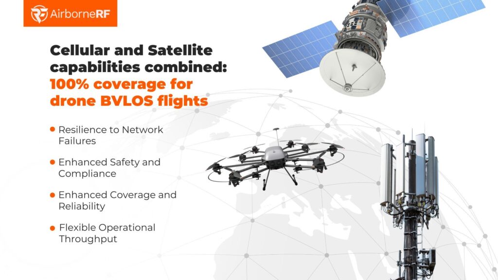
Enhanced Safety and Compliance
Combining cellular and satellite technologies together ensures that drones can maintain real-time communication with their control stations. This capability is crucial for adhering to safety regulations in Beyond Visual Line of Sight (BVLOS) operations, where continuous and uninterrupted communication is essential. This coherent communication is vital for enabling precise navigation, effective airspace management, and maintaining control over unmanned aircrafts in a variety of diverse and unpredictable flight conditions. Additionally, this integration supports enhanced situational awareness, which is necessary for the safe and efficient operation of drones over long distances and in challenging environments. Losing connectivity during flight operation can lead to safety issues or operational issues, such as the UAV abandoning the mission, or both. Therefore, by combining these technologies and the information about what is possible where, UAV operators can ensure the highest levels of safety and reliability in BVLOS missions.
Enhanced Coverage and Reliability
By leveraging both cellular and satellite networks, drones can achieve continuous and steady connectivity throughout flights. This dual-network strategy allows drones to seamlessly switch between cellular and satellite connections, depending on geographic location and network availability. This constant ability to alternate between two networks ensures robust and reliable communication links, even in remote or geographically challenging environments. As a result, the operational range of drones is significantly expanded, enabling them to perform effectively in a wider variety of locations and conditions.
Flexible Operational Throughput
Drones equipped with dual connectivity options offer enhanced operational flexibility across a wider range of diverse and complex environments. In urban areas, they can utilise high-speed cellular networks for tasks that demand rapid data transfer, ensuring efficient performance in data-intensive applications. Conversely, in remote or underserved regions, these drones can switch to reliable satellite communications maintaining strong connectivity where cellular networks may be unavailable or inadequate. This ability to toggle between high-speed cellular and dependable satellite networks allows drones to optimise varying throughput and latency requirements in the most cost-effective way.
Resilience to Network Failures
The incorporation of both cellular and satellite connections allows drones to be equipped with a fail-safe against potential damaging network failures. This redundancy is crucial, as it allows continuous communication and operational capabilities with the control centre, even if the network fails or goes down entirely. Consequently, mission reliability is significantly enhanced, minimising any potential downtime during operations. This approach bolsters the overall reliability of drone missions.
This particular new wave of connectivity not only highlights the potential for increased efficiency in these operations, but also emphasises the need for ongoing innovation in order to fully embrace the future of BVLOS operations. The dual-network strategy enhances safety, compliance, and operational flexibility, allowing drones to operate effectively across a variety of environments. The ability to switch between networks reduces the risk of communication failures, ensuring robust mission reliability. Therefore, aggregated connectivity and holistic connectivity performance awareness, not only meet the critical demands of modern urban air mobility, but also expand the operational range and efficiency of drone missions, paving the way for safer and more reliable air transportation in the future.
Conclusion
The integration of cellular and satellite technologies marks a significant development in BVLOS drone operations, addressing critical connectivity challenges and enhancing operational capabilities. This dual-network approach ensures continuous, reliable communication, crucial for safety and compliance, and expands the operational range of drones. The flexibility to switch between high-speed cellular and dependable satellite networks optimises performance across diverse environments, making drone missions more efficient and resilient. As urban air mobility continues to evolve, multi-link connectivity together with holistic connectivity performance and availability awareness will be essential for safer and more reliable BVLOS operations, driving forward the future of aerial surveying, mapping, inspection, and beyond.
Would you like to understand how AirborneRF enables the above? Message us today!