AirborneRF will play a key role in enabling beyond-visual-line-of-sight (BVLOS) UAV operations in the latest European Union funded SESAR U-Space Integration research project, ‘GOF 2.0 Integrated Urban Airspace Validation’ (GOF 2.0).
A follow-up to the SESAR JU Gulf of Finland (GOF) U-space project, which successfully demonstrated the safe airspace integration of unmanned aerial vehicles (UAVs) in 2019, GOF 2.0 will go a step further and test drone flights, specifically using communication and connectivity, in urban airspace over the next two years.
Revolutionising the future of airspace.
The 2019 GOF project highlighted the importance of building a scalable U-space architecture and of ensuring that the market is interoperable and open, with authority oversight to enable easy sharing of safety-related information.
GOF 2.0 will build on this to safely, securely and sustainably demonstrate operational validity of serving combined Unmanned Aerial Systems (UAS), electric vertical take-off and landing (eVTOL), and manned operations in a unified, dense urban airspace using existing cellular networks to connect to Air Traffic Management (ATM) and U-space services and systems.
The consortium consists of twelve key players from across the entire industry, from air navigation service providers to technology and software specialists (full list of members can be found below). It will use its expertise to ensure safe flight operations in all classes of airspace to provide all airspace users with fair and efficient access to the shared airspace.
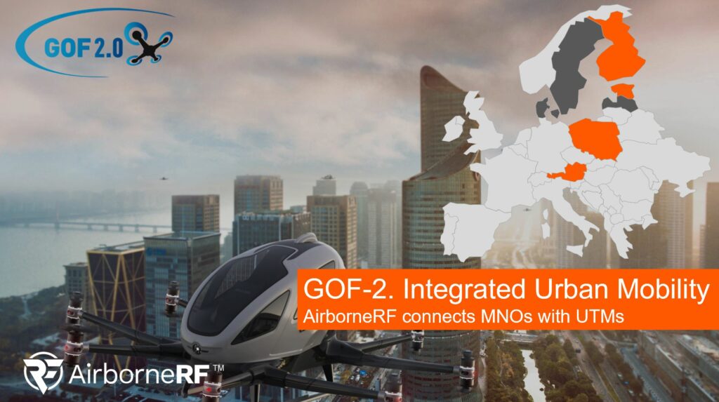
A key part of the project is to show that cellular connectivity is a technology enabler for safe, efficient and reliable traffic management of all aircraft at a low level. Communication service providers (CSPs) are uniquely positioned to provide that data to the ecosystem and AirborneRF enables this transfer of data via our leading data processing and sharing solution.
“A drone has to have permanent connectivity to a cellular network so that it can communicate with the flight management systems. AirborneRF software integrates with the cellular network operators so that they can provide the required information to the aviation management systems.”
Thomas Wana, CTO at Dimetor and responsible for the AirborneRF development
The overall ambition of GOF 2.0 is to demonstrate beyond the state-of-the-art of integrated U-space/ ATM operations and outline the path towards a fully integrated and automated airspace management regime, in alignment with SESAR’s European ATM Masterplan 2020.
The team behind AirborneRF is excited to be part of such a ground-breaking project which has the potential to revolutionise the future of airspace.
This project has received funding from the SESAR Joint Undertaking under the European Union’s Horizon 2020 research and innovation programme under grant agreement No 101017689.
Consortium members:
About Dimetor & AirborneRF
Dimetor is a software company bridging the data gap between communications service providers (CSPs) and aviation eco-systems. Through its world-leading platform, AirborneRF, they help provide supplementary data that is critical for safe BVLOS drone operations. AirborneRF focuses on (a) the 3D corridors in space that have sufficiently good connectivity for drone operations (e.g. for networked remote ID, command and control, payload communication), and (b) the population density for ground risk assessment, based on anonymized cellular mobility data. Developed by experts in mobile communication networks, aviation and drone technology, AirborneRF also provides live notifications from the CSP networks in case of any issue during flight operation may occur. AirborneRF software has been deployed worldwide, including Australia, Switzerland, the Netherlands and the United States. Visit www.airborneRF.com for more information.
About SESAR
As the technological pillar of the Single European Sky initiative, SESAR aims to modernise and harmonise air traffic management in Europe. The SESAR Joint Undertaking (SESAR JU) was established in 2007 as a public-private partnership to support this endeavour. It does so by pooling the knowledge and resources of the entire ATM community in order to define, research, develop and validate innovative technological and operational solutions. The SESAR JU is also responsible for the execution of the European ATM Master Plan which defines the EU priorities for R&D and implementation. Founded by the European Union and Eurocontrol, the SESAR JU has 19 members, who together with their partners and affiliate associations will represent over 100 companies working in Europe and beyond. The SESAR JU also works closely with staff associations, regulators, airport operators and the scientific community.
About EANS (Lennuliiklusteeninduse AS)
Estonian Air Navigation Services (EANS, Lennuliiklusteeninduse Aktsiaselts) is efficiently operating public limited company acting under private law, which provides Air Navigation Services in Tallinn FIR and at Tallinn and Tartu aerodromes. The Company has a long and fruitful experience in the modernisation of Air Traffic Management (ATM) and Aeronautical Information Management (AIM) systems, airspace organisation and procedures design and implementation. EANS has experience in the realisation of EU funded development and implementation projects. In year 2013 new PRNAV/CDA procedures were implemented in Tallinn TMA and Sherpa project were successfully finalised– building capacity for SBAS LPV procedures design and implementation, ASM Tool as well as DLS service implementation. In 2012-2014 we worked on IDSG IDP implementation projects. EANS participates actively in different kinds of regional initiatives, i.e. Northern-European FAB implementation projects, in the projects of Borealis ANSPs alliance, particularly expanding the recently implemented NEFAB FRA into NEFRA and Borealis FRA initiatives.
About CAFA Tech
CAFA (Center of Automated Flights Applications) develops 3D maps for automated drone flights. CAFA 3D maps visualize drone flights in the true 3D environment. CAFA has developed a Tallinn 3D Map and its web application for drone operations (https://cafa3d.com/3dpoc). CAFA 3D map has also Google Earth 3D cities integration for planning low altitude drone operations in Europe and in USA. 3D Map is an essential part of safe and efficient drone route and flight corridor planning.
About Droneradar
Droneradar Sp. z o.o. (www.droneradar.eu) is a technology provider for PansaUTM. Droneradar developed mobile application, supporting building full aeronautical awareness across Drone community, two-way non-verbal communication (CDDLC – Controller Drone Data Link Communication) and also unique algorithm for judging possibility of the flight. Droneradar is daughter company of dlapilota.pl Sp. z o.o. Polish General Aviation portal and aeronautical data publisher, established in 2002. Currently, Dronereadar activities are focused on autonomous flights, automation of processes between UTM and ATM world, CIS interfaces standardization. Droneradar is active on European and National legislation level supporting many standardization organizations.
About EHang
EHang (Nasdaq: EH) is the world’s leading autonomous aerial vehicle (AAV) technology platform company. Our mission is to make safe, autonomous, and eco-friendly air mobility accessible to everyone. EHang provides customers in various industries with AAV products and commercial solutions: air mobility (including passenger transportation and logistics), smart city management, and aerial media solutions. As the forerunner of cutting-edge AAV technologies and commercial solutions in the global Urban Air Mobility (UAM) industry, EHang continues to explore the boundaries of the sky to make flying technologies benefit our life in smart cities. For more information, please visit www.ehang.com.
About Fintraffic ANS
Fintraffic ANS is responsible for managing the use of Finnish airspace as well as providing air traffic control services at airports in Finland. En-route services include area control services in Finland, airspace management, aeronautical search and rescue and air traffic flow management. Our technological air navigation services maintain and develops all navigation, communication, surveillance and monitoring systems related to en-route services, such as the air traffic control and radar systems required for flight surveillance. Our customers include airports, the commercial aviation industry, the Finnish state’s aviation operations and military aviation, general aviation and pilot training schools.
About FREQUENTIS
Frequentis, headquartered in Vienna, is an international supplier of communication and information systems for control centres with safety-critical tasks. Such ‘control centre solutions’ are developed and marketed by Frequentis in the business sectors Air Traffic Management (civil and military air traffic control, air defence) and Public Safety & Transport (police, fire brigade, ambulance services, shipping, railways). As a global player, Frequentis operates a worldwide network of branches, subsidiaries and local representatives in more than 50 countries.
Products and solutions from Frequentis can be found in over 35,000 operator working positions and in approximately 140 countries. Founded in 1947, Frequentis considers itself to be the global market leader in voice communication systems for air traffic control with a market share of around 30%. In addition, the Frequentis Group’s AIM (aeronautical information management) and AMHS (aeronautical message handling) systems, as well as GSM-R systems for Public Transport are industry leading global solutions.
The shares of Frequentis AG are traded on the Vienna and Frankfurt Stock Exchange under the ticker symbol FQT (ISIN: ATFREQUENT09). In 2019, the Frequentis Group had about 1,850 employees worldwide and generated revenues of EUR 303.6 million and EBIT of EUR 17.2 million.
For more information, please visit www.frequentis.com.
About IBCh PAS PSNC
Poznan Supercomputing and Networking Center (PSNC) affiliated to the Institute of Bioorganic Chemistry of the Polish Academy of Sciences is an internationally known node of the European Research Area in the field of IT infrastructure of science and an important R&D center in the field of information and communication technologies (ICT). As a development centre of e-Infrastructure, PSNC designed and built the Metropolitan Network POZMAN, High Performance Computing Center and the national broadband network PIONIER, maintained and still developed by PSNC.
PSNC is an important element of global research and development base, implementing projects mainly under the European Union Framework Programmes, but also supporting R&D initiatives with more than a thousand partners from around the world. PSNC has participated and participates in 215 such projects, coordinating 20 of them. For over a quarter century of its activity 282 research and structural projects have already been implemented in the Centre (coordinating as many as 38 of them), which is one-seventh of all PSNC projects.
PSNC has been operating with a mission: “Integration and development of information infrastructure for science”. The potential of the infrastructure and the several dedicated laboratories, including a fleet of unmanned aerial vehicles, are the basis of innovative applications in agriculture, logistics or education. The possibilities are being expanded with the new experimental and laboratory space at the airport in Kąkolewo with dedicated data collection and processing services and a connection to the PIONIER network infrastructure.
About Polish Air Navigation Services Agency (PANSA)
Every day Polish Air Navigation Services Agency ensures safety of passengers in more than 3,000 flights over Poland. We have one of the biggest airspace in Europe: over 334,000 km2. Before coronavirus pandemic almost a million overflights, approaches, take-offs and landings in 2019 were supervised by almost 600 air traffic controllers employed in Polish Air Navigation Services Agency, as well as around 260,000 General Aviation flights under watch of the Flight Information Service (FIS). Polish Air Navigation Services Agency is also the only institution in Poland training and employing civil air traffic controllers (ATCOs). We also provide Flight Inspection Services for monitoring the proper operation of ground-based navigation aids from the air. Our air traffic controllers are supported by advanced technology. Over 200 devices located throughout Poland guaranteeing safety of air traffic within the Polish airspace: air-ground communication systems, RNAV systems, ILS – DME systems supporting smooth and precise landing in low visibility, radars. PANSA also builds and develops tools for efficient management and planning of airspace: CAT (Common Airspace Tool) – that ensures accurate and efficient management of the airspace, PANDORA – that supports controllers and other operations personnel with the wide spectrum of a real time aviation data, raising their situational awareness, PANSA UTM – system for UAV flight coordination, TRAFFIC – Track Advisor for Flight Information Concerns, which provides the ATM system information from flight plans, as amended and complementary messages.
About Robots.Expert
Robots.Expert (REX) is a consultancy focused on unmanned aviation. REX help companies adopt new drone technology in their business, often through live demonstrations to jump-start understanding of the potential. Robots.expert main focus in the Nordic and Baltic countries is to advance a strong network with drone stakeholders in Europe. REX’ personnel have a strong background in UAS, technology and strategy, as well as in project management to support the tasks of facilitating demonstrations and to manage large projects or consortia. Robots.expert is the ambassador in Finland for EIP-SCC Urban Air Mobility.
About Threod Systems
Threod Systems specializes in developing, producing, and operating Unmanned Aircraft Systems (UAS) that are designed for information collection and exploitation in wide range of applications. Threod supports the decision-making process on every level of command. Threod Systems is known for rapid product development and tailor made UAS solutions for small multirotors, fixed-wing UAV platforms, and in-house developed subsystems. Threod System designs, develops, manufactures and operates Unmanned Aircraft Systems and subsystems for information collection, surveillance and other tasks related to unmanned sensing including VLOS and BVLOS operations.
About Unmanned Systems Limited
Unmanned Life is a multi-award-winning deep tech company. Our core IP is the world’s first 5G, Edge and AI-enabled software platform which can deploy and manage at scale, integrated swarms of different types of robotic devices (UAV, AGV etc.) of varied capabilities, working together autonomously to deliver commercial grade solutions for the Industry 4.0 and Smart Cities market sectors. Our Mission is to become the Go-To Software Platform for Seamless Orchestration of Autonomous Robotics
We are comprised of a small but highly talented team (punching well above our weight) of multiple nationalities, educated at the world’s top schools in their respective disciplines with experience in frontier and emerging technologies such as 5G, Cloud Computing, AI, Robotics, Autonomy as well as Business Leadership, Management and Sales in some of the world’s leading companies. We have been recognized across the world by various technology giants, fortune 500 industrial behemoths, governments and associations winning awards such as “Most Innovative Company” by Alibaba Group (2019), “Most Innovative Technology” by NTT Group (2019) and the UK National Technology Award (2018).
Finally, we have existing projects, pilots, and strategic partnerships with industry behemoths in technology, telco, logistics and government such as Telefonica, SEAT, Walmart, BT, Etisalat, Dubai Future Foundation and the City of Vienna to name a few. Our diverse and immensely motivated team unites on our mission to become the go to software platform for seamless orchestration of heterogeneous robotic swarms. To find out more visit: https://unmanned.life/
About Vaisala Oyj
Vaisala is a global leader in weather, environmental, and industrial measurements. Building on over 80 years of experience, Vaisala provides observations for a better world, with space-proof technology even exploring Mars and beyond. We are a reliable partner for customers around the world, offering a comprehensive range of innovative observation and measurement products and services. Headquartered in Finland, Vaisala employs approximately 1,900 professionals worldwide and is listed on the Nasdaq Helsinki stock exchange.