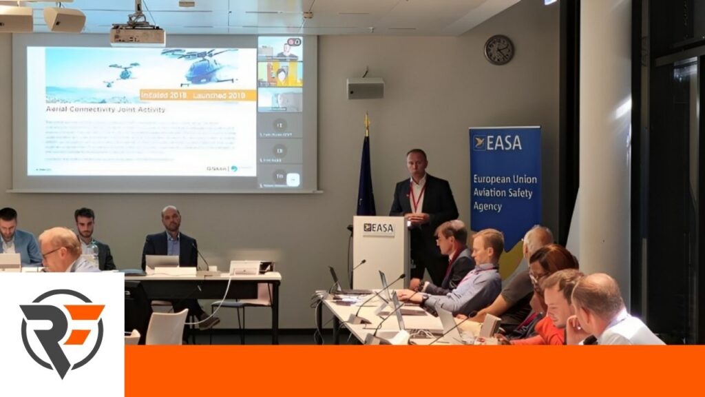
Our CEO and co-founder, Thomas Neubauer, recently represented the Aerial Connectivity Joint Activity (ACJA) at the EASA workshop on population density services for UAS operations. During his presentation, Thomas explained how Mobile Network Operators (MNOs) are entering the aviation industry by offering population density services to drone operators with a more than 95% reliability rate.
The event and discussion revolved around the accessibility of mobile data for risk assessments to enable safe drone operations. In addition, Thomas explained the interface standards between mobile operators and the UAS ecosystem, drawing on his own experience leading a work task dedicated to bridging the gap between the industries.
The ACJA is not new. It was initiated in 2018 and launched the year after in 2019. The Aerial Connectivity Joint Activity (ACJA) is a collaboration between the GSMA and the Global Unmanned Traffic Management Association (GUTMA), which represents a significant step towards creating unified systems to interface between the aviation and telecommunications industries. As uncrewed aviation begins to increasingly rely on Mobile Network Operators (MNOs) for connectivity to empower safe airspaces, the ACJA was founded as a way to foster dialogue and collaboration between these two industries.
The goal of ACJA is to highlight how mobile services are critical to Unmanned Aircraft Systems (UAS), Unmanned Traffic Management (UTM) Service Providers, Air Navigation Service Providers (ANSPs), and regulators. By working together to identify and address common challenges, the initiative aims to provide consolidated standards proposals to each development body. The work is divided into four different work tasks, including (1) Cellular Standard Coordination, (2) Interface for the Data Exchange between MNOs and the UTM ecosystem, (3) Standard Aerial Service Profile, and (4) The development of Minimum Operational Performance Specifications (MOPS) and minimum aviation system performance standards (MASPS). Thomas leads the second task with his experience in developing and managing Dimetor and its AirborneRF software.
How can aviation utilize data from existing telecom infrastructure?
The Aerial Connectivity Joint Activity meets every two to three weeks to discuss how they can begin to enable interactions between the telecommunications and aviation industries beyond “Please turn off your cell phone. It’s a safety risk to aviation.” As mentioned earlier, this workshop from EASA focused specifically on how lower airspace operations in aviation need telecom-powered connectivity for increased safety, especially when it comes to scale.
This increase in safety comes directly from the ground risk data from SIM density mapping provided by airborne connectivity, but since most drone professionals are not telecom infrastructure experts, we often hear three common questions:
- How can I easily access this data without being a telecom expert?
- How reliable is this data once I have it?
- How can I automate the process of accessing and using this data?
These questions may seem simple, but without the interface between the two industries, it will take something truly innovative to meet the challenge of answering them. And, if we are to realize our dreams of millions of drones in the sky, we need an infrastructure that utilizes the power of automated and reliable interfaces. That is the goal of the ACJA.
In January 2021, ACJA published a document called the Interface for Data Exchange between MNOs and the UAS Ecosystem. Since its publication, the document’s findings have been used in field validations with the SESAR Joint Undertaking U-space Project, which has ongoing validation in Australia and Africa to research how data from telecom networks can be used in an automated manner in aviation.
Although the projects are not yet complete, initial findings show that SIM density data is useful for strategic planning, flight clearance, and the tactical aspects required during flight operations. This may sound obvious to some drone professionals, but there has not been a solid understanding of this interface in aviation until now, making ACJA’s research regarding these interfaces some of the most innovative in the world.
Bringing standardization efforts into operational planning services
In order to move from one country to another and still use your phone with the same number and connect to the internet after a flight, mobile operators had to start the process of standardization and globalization. The same process needs to happen for the drone industry, including what industry professionals call a subscription service. This will allow, for example, the potential for completely BVLOS operations over the course of a two-hour flight, as harmonization between these services will allow for changes to be made during the flight, such as live updates. This can also help drone operators to access dynamic data for risk assessments, as considered by current SORA requirements and M1 mitigations.
The key finding here is that there is no standardization body between the telecom and aviation industries, which is why both the ACJA and the GSMA have started to generate traction in this area. The GSMA Open Gateway Initiative, for example, was just brought into this effort a few weeks ago by one of the largest telecom operators to create an open API.
An open API, for those unfamiliar with the term, is a type of code that everyone has access to. Any organization that wants to use that API can then take the code directly and implement it from their side, allowing for an immediate level of harmonization and standardization because everyone will be working with the same API. The next step in creating a globalized interface is to take that API and make it part of CAMARA, an open source project within the Linux Foundation to define, develop and test the APIs. CAMARA is working closely with the GSMA Operator Platform Group to align API requirements and publish API definitions and APIs.
Want to know more? Watch the entire presentation here!